Walking with friends last night, we spotted this peculiar pedestal on the corner of 11th and Ontario (here it is on Google Maps). It’s about three feet high, made of granite (I think) and has shallow lines engraved into it at irregular intervals. There’s some graffiti on it.
Click the dodgy iPhone photo for larger version:
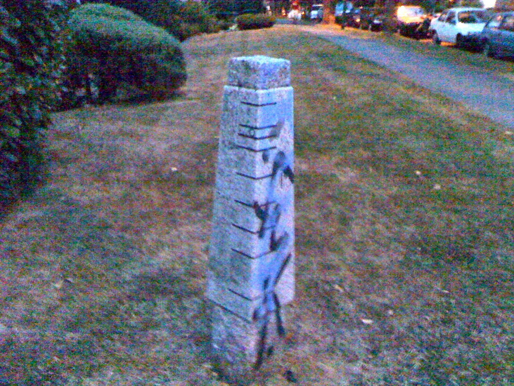
Do you know what this thing is?
UPDATE: This comment, from Barb at the City of Vancouver, provides the answer.

I think that’s called a “post” or “stone pillar.” You find them in places that civilization has arisen.
TTFN
Travis
Based on my vast knowledge of alien civilizations (not really) and sci-fi movies, I’d say that it’s a marker of some sort. You know when they have to place a certain number of these in very specific locations to create a geometric shape and then something crazy happens like a massive laser. Then, Will Smith saves the day and we walk out feeling cheated out of our $12.
They’re digging in the wrong place!
It’s where a very horny granite creature was defeated and buried and….they couldn’t dig deep enough to cover it’s manhood!
More seriously, there are various pieces of public art and sculpture along Vancouver’s cycling routes. Ontario Street is one of them. But the obelisk is not on the official list either. So it remains a mystery.
Some guesses: it could record snow levels for various past years, but it could also represent streets, or a PCR analysis of someone’s DNA, or something else.
That is an excellent array of answers. I may just have to contact the Parks Board.
You need to contact Bryan Newson at the cultural affairs office/public art dept. He’d know. bryan.newson@vancouver.ca
I didn’t find it in my search online or in my copy of “Public Art in Vancouver” a great little book.
Looks to me like a rune stone or an ogham.
Why didn’t I know the word “ogham” yesterday when I was playing online scrabble?!
According to Linda Chow with the City of Vancouver engineering / Greenways + Neighbourhood Transportation it is a marker for the Ontario Street greenway. There are a few of them along the greenway. It’s like a map — the lines mark cross streets and the circle is a ‘you are here’ reference. They were installed around 2006. And thank you for drawing the graffiti to her attention.
-Barb Floden, Vancouver Park Board communications
That’s a neat if obscure map, but I had my own idea what it was.
I used to walk by that all the time, and always fancied that it was the centre of the city….or the centre of what the city was at some moment in time.
Ontario is 0 block after all. Alas.
Indeed, somebody suggested that to me as a possibility. That seemed to make a lot of sense.
In some older neighbourhoods in Victoria, there are granite posts like this that can be found near street corners. They’re actually hitching posts that are over 100 years old. Back when people rode horses instead of drove in cars, they would tie up their horse at these hitching posts. Some of them still exist, here’s a photo of one of them: http://www.flickr.com/photos/whiteoval/2630535616/